About Me
I relocated to the Chicago area after an internship with National Geographic Magazine in Washington D.C. Prior to my time in the Capital, I studied Geographic Information Systems (GIS) and cartography after completing my B.A. through the University of Wisconsin-Madison. GIS and cartography compliment my interest in design including UI/UX and data visualization. I firmly believe that both form and function - concepts present in many mapping and GIS practices - can be effectively applied to user experience and interface design. Initially inspired by the assignments and research I completed during my academic years, I now improve users' experiences with digital products. This portfolio houses the work I completed before transitioning to UX/UI including mapping and data visualization.
When I'm not UX-ing, I enjoy drinking delicious coffee and reading intriguing books, attending Meetups, and exploring Chicago. I love to snowboard in the colder months (I actually used to teach kids) and bike by the lake on warmer days. I also randomly design tattoos for my friends from time to time. Take a look around and feel free to send any questions or collaboration inquiries my way: Contact Me
National Geographic Maps | Static Maps | Interactive Maps | Academic Publications
National Geographic Magazine Maps
In the Fall of 2014, I had the opportunity to intern as a cartographer with National Geographic Magazine's graphics and maps team. Since the majority of editorial content is increasingly pushed to the web, I focused primarily on producing and editing online news maps. Click on an image below to access the link of the corresponding news article for each map (including the sources used).
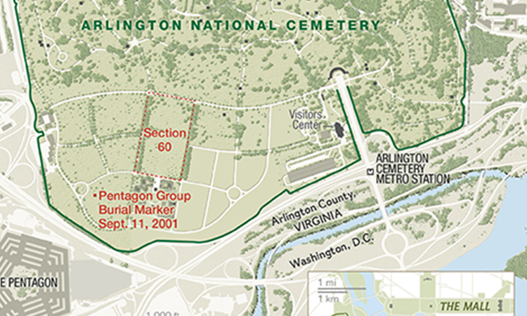
Arlington Cemetery Emphasizes Section 60 of Arlington National Cemetery in Virginia
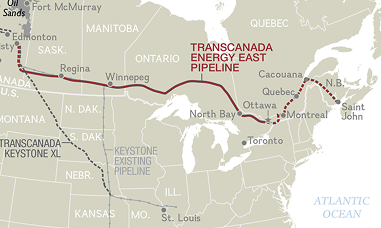
Proposed Pipelines Existing and Planned Pipelines in the U.S. and Canada
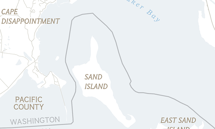
East Sand Island A Popular Breeding Ground in Oregon for Cormorants, Birds that Feed on Salmon
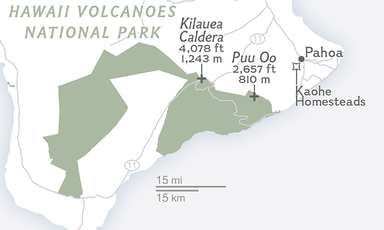
Hawaii Volcano Kilauea Volcano on the Island of Hawaii, Dangerously Erupting Near Local Towns
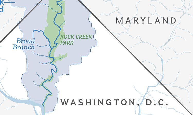
D.C. Stream Restoration Project: Broad Branch Stream in the Rock Creek Watershed
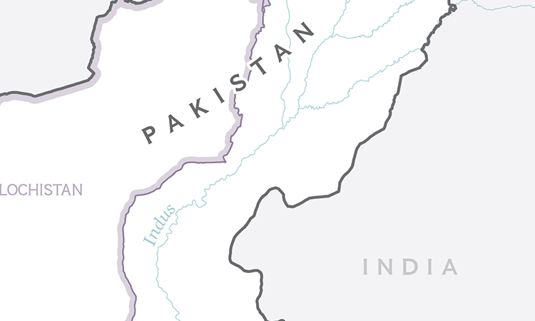
Polio Series First Map accompanying a Story Series on the Polio Epidemic in the Middle East
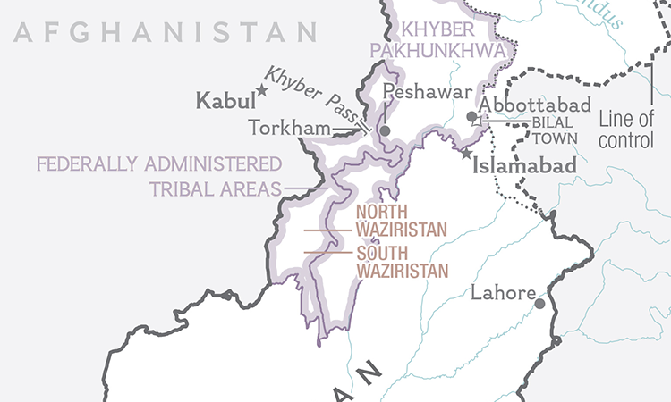
Polio Series Second Map accompanying a Story Series on the Polio Epidemic in the Middle East
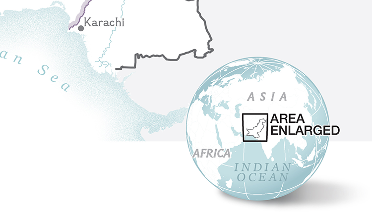
Polio Series Third Map accompanying a Story Series on the Polio Epidemic in the Middle East
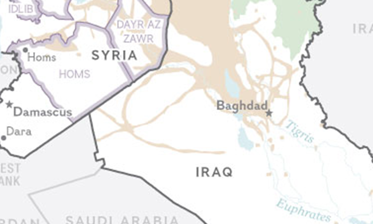
Polio Series Fourth Map accompanying a Story Series on the Polio Epidemic in the Middle East
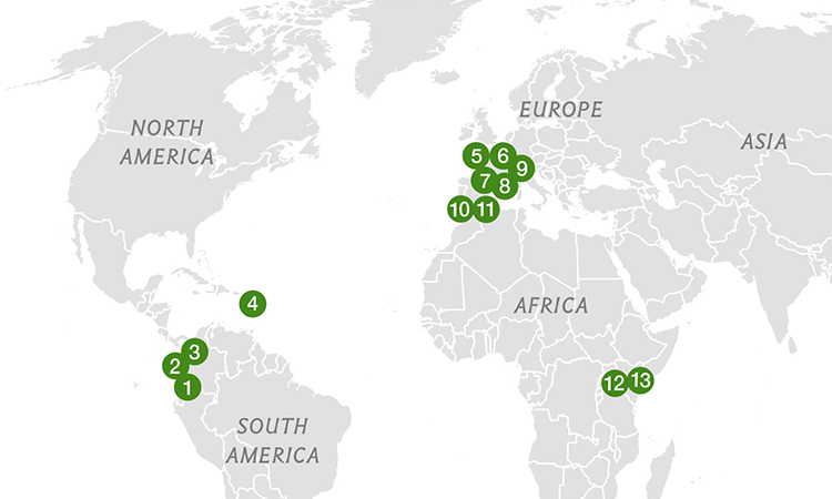
IUCN Green List The International Union for Conservation of Nature's "Green List" of Successfully Protected Areas
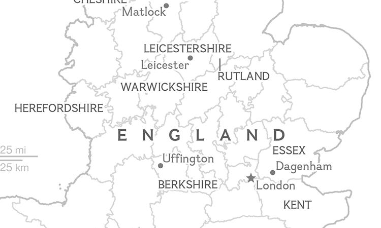
Historic Counties England's Thirty-Nine Historic Counties and Their Impact on British Identity
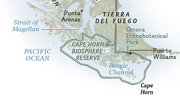
Cape Horn Biosphere An Expedition to Cape Horn Biosphere Reserve at the Base of Chile
Static Maps
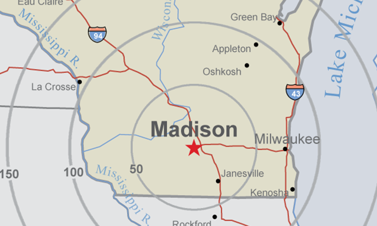
Madison Madison, WI: Home to UW-Madison, the Midwestern hub of higher learning
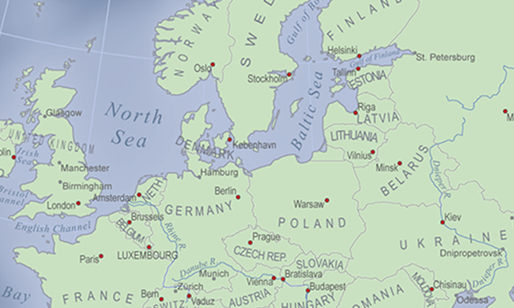
Europe A political map of Europe emphasizing typography + visual hierarchy
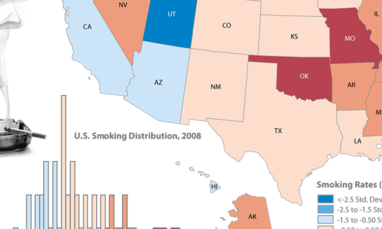
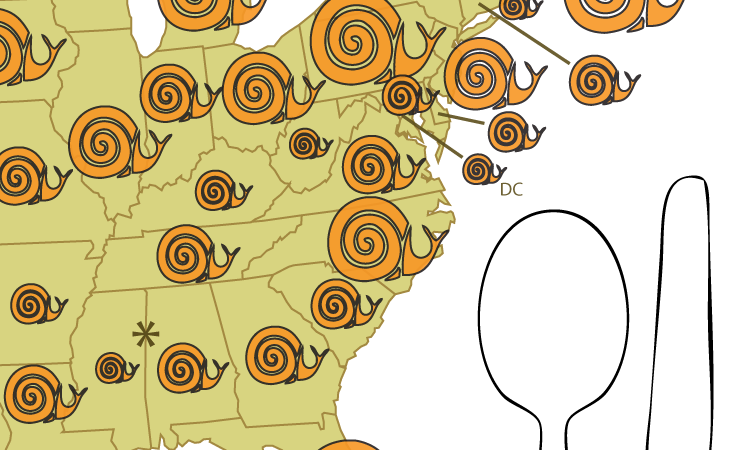
Smoking Choropleth illustrating the distribution of adult smoking rates in the U.S.
Slow Food Proportional symbol map representing the number of Slow Food USA chapters by state
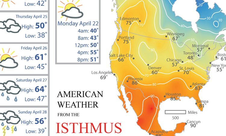
Weather Isoline weather map of North America, including Madison, WI’s daily and weekly forecast
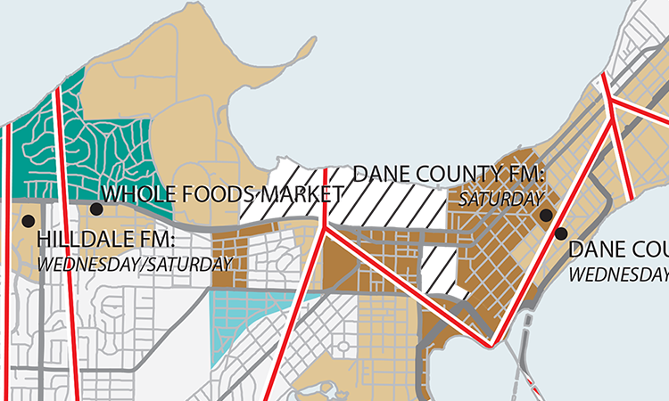
Food Access The spatial connection between income and distance to health food sources in Madison, WI
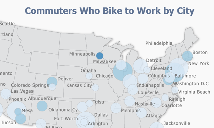
Bikes The 50 most populous cities in the U.S. and how they compare for biking stats
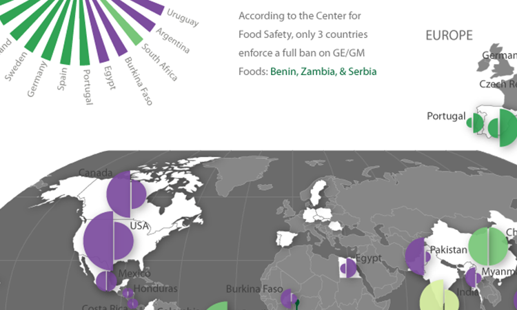
GE/GM Food GE/GM and organic crop production by country, including food labeling regulation information
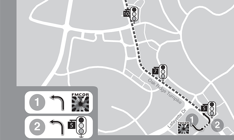
Wayfinding A class Seminar Project exploring effective visual wayfinding techniques for those who cannot read or have low reading ability
Interactive Maps
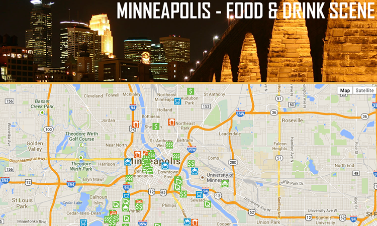
MPLS Tourism
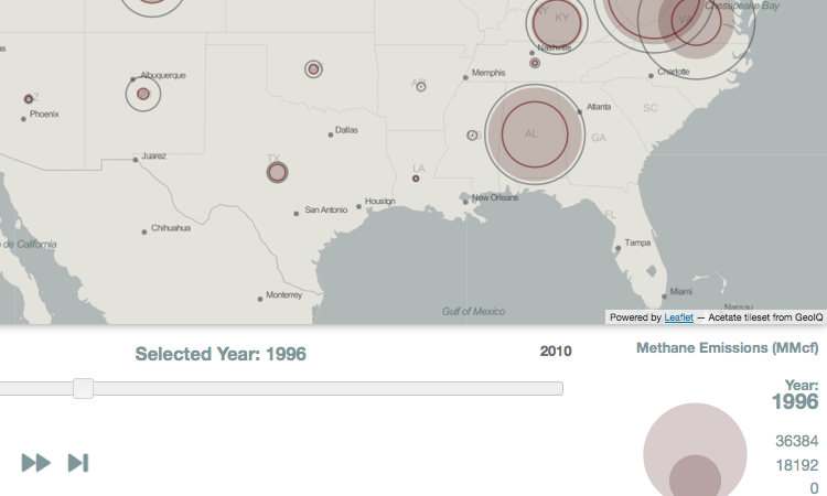
U.S. Coal Mining Emissions
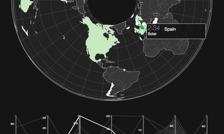
Renewable Energy
Academic Publications
While completing my GIS certificate, I served as a research assistant for a cartography professor on a project analyzing the usability and utility of the National Oceanic and Atmospheric Association's Sea Level Rise Viewer. I developed a competitive analysis comparing various sea level rise visualization tools on over 50 categories, noting important design qualities, in addition to usability and utility metrics, for each tool. I also worked with a fellow student to code transcripts of wireframe testing with several potential stakeholders who may use the tool. Ultimately this research culminated in design suggestions for NOAA's new project: the Lake Level Viewer, as well as academic publications and presentations. Click the paper title below to access the PDF.
Roth RE, C Quinn, and D Hart. 2015. The competitive analysis method for evaluating water level visualization tools. In: A. Vondrakova, J. Brus, and V. Vozenilek (eds) Modern Trends in Cartography, Lecture Notes in Geoinformation and Cartography. Chapter 19: 241-256. [uncorrected pre-print]
View the new NOAA Lake Level Viewer | View the NOAA Sea Level Rise Viewer